Everyone says you have to have maps of your area in your gear. That’s true, but how much time did you spend deciding exactly what kind of maps to take. If you just stuck a state road map in your Bug Out Bag, then you should reconsider and take the 3 types of maps that should be in your survival gear.
Also, make sure you actually know how to read a map as well before SHTF. It’s a crucial skill.
SKIP AHEAD
Types of Maps That Are a Must
Detailed Local Map

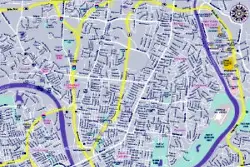
You need the most detailed local street map you can possibly get. By local I mean just your town, or if you are in a large city, your neighborhood and the areas you frequent.
Here many people might say, “oh I know my way around my town like the back of my hand, I don’t need a map for that.” We’ll maybe you do.
In an urban survival regional emergency, like a flood, hurricane, or other man made disaster any number of things could happen that will be much easier navigated with a highly detailed local map.
Maybe a couple of the roads you usually take are blocked or flooded. Maybe you need to get out of town in a direction you don’t usually go. (One of these should also be in your Get Home Bag)
Regional Topo

If you think of the maps you need in an expanding circle, after your detailed local map you are going to need a regional topographic map. In the event of a serious regional problem or a total collapse scenario you are going to need to head towards important natural areas, like a water source.
Whether walking or driving there will certainly be chaos on the major roads and the smart people will be cutting across country. You need to be able to plan around mountains and rivers.
Extended Area

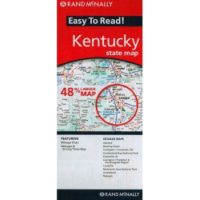
Wherever you might be going, it’s almost certain that once you get outside of your local area you don’t know all of the roads. Taking an extended area road map, like your state road map that I mentioned earlier, and the surrounding states if applicable, just makes sense. This can be an important tool, not only for roads to follow, but for noticing cities and roads to purposely avoid.
Tech vs Paper Maps
One question you may be asking yourself is, “should I use maps on my phone, a dedicated GPS device, or traditional paper maps?”
Technology is great and it allows us to carry a lot of different maps right in our pocket. Additionally, they can track our progress, estimate distance, and pinpoint locations.
However, technology and supporting networks can easily fail. Which is why in addition to them, physical maps should always be carried.
Keep it Protected
Plain paper maps are going to be the cheapest option, but in a survival situation they will wear out quickly.
Allowing something as important as a map to deteriorate is not an option. Keep your maps protected by purchasing laminated maps, laminating them yourself, or at a minimum keep them in resealable plastic bags.
More?
Amazon has a decent selection of topographic and state road maps (just search for your state), but you will probably have to get your super local maps at the city information city.
More ideas? A good compass or an all in one GPS/Radio – The Garmin Rino (in a class by itself).
Do you pack any other types of maps? If so tell us about them, and why you think they will be useful.
photos by: flickmor and backgarage

